Abdul Kalam Azad
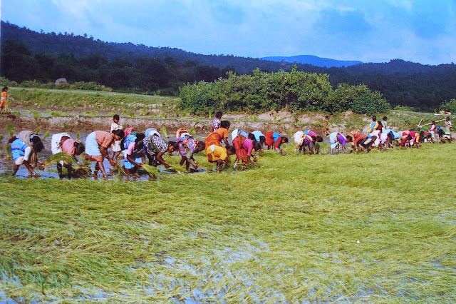
Assam is one of the most flood prone states in North-Eastern states of
India. Flood has almost become an annual event in Assam creating mayhem among
the masses. Except two the hill districts of Karbi Anglong and North Cachar
Hills, all the plain districts of both Brahmaputra and Barak Valley of Assam
are vulnerable to floods in every monsoon starting from May/June to
September/October. The flood water causes huge damage to crops, lives and
properties (Mandal, 2010). As far as
scale is concerned, the annual flood water from river Brahmaputra and its 28
northern and 18 southern tributaries and river Barak affects three-fourth of
the total number of districts in the state (Phukan,
2005). In 2012, Indian Space
Research Organization carried out a study through satellite and remote sensing
for extraction of flood disaster food print and assessing the disaster impact
in Assam. The study shows that about
4.65 lakh ha area was submerged, 23 of the 27 districts in Assam had more than
5% of the total geographical area submerged, about 3829 villages marooned and
23.08 lakh people were affected (C. M.
Bhatt, G. Srinivasa Rao, Asiya Begum, P. Manjusree, S. V. S. P. Sharma,L.
Prasanna and V. Bhanumurthy, 2013).

Flood: What History says?
However, history says that flood was not so
cruel in Assam just half a century ago. Prior to the great earthquake of Assam
in 1950, the magnitude of flood was much lesser and people used to welcome the
flood (Phukan, 2005). Furthermore, travellers and soldiers who visited Assam in the
medieval period wrote about the amazing rivers and awe-inspiring seasonal
rains. Assam’s native people used these factors to their advantage in their
battles against other armies” (Barbora, 2015).
Causes behind the increasing number of flood
But the things didn’t go
well as the time passed. Prof. Sanjay Barbora argues that the advent of British
colonial role and tea plantation as well as other cash crops changed the landscape
of Assam in 19th century. The colonial government built railway
track and embankment to protect the tea gardens from water-logging. Independent
government also followed much of the British path and built embankments and
dykes with very short-term economic logic in mind, which radically changed the
social structure of the place. Thus, construction of embankment for one village
creates waterlogged condition in the fields of another (Barbora, 2015).
Prof. Phukan says flood
occurs in Assam as a result of multiple factors like a) natural, b) ecological,
and c) anthropomorphic. These factors combined with other climatic factors like
depression of Bay of Bengal, high sediment transport, deforestation, shifting
cultivation, earthquake, landslide etc are influencing the flood situation in
Assam (Phukan, 2005). Apart from short-sighted flood control and
development policies, destruction of wetlands is another factor which worsening
the flood situation in Assam; the ‘Bils’ in Brahmaputra Valley and ‘Haors’ in
Barak Valley, which work as natural reservoirs are shrinking drastically. In 1988, total wetland covered area was 49000
ha which has shrunken to here 35630 ha in 2005 (ibid). Within a period of just
17 years, more than 27% of wetland has been destructed. There is no doubt that
the rate of this destruction has been increasing.
There were large number
of natural water reservoirs in and around Guwahati city; the human greed has
destroyed almost all of them. At one hand wetlands and natural water reservoir
are being destroyed and high rise buildings are being constructed, including
international chain of hotels. One the other, the hills and forest are also not
spared. Experts say that one of the most important factors behind the flash
flood in Guwahati is the mindless human encroachment in the hills, wetlands and
water canals (Deka, 2018). Off late
administration is working on to evict the illegal encroachment in those natural
resources and so far the result is quite encouraging.

Is Development Responsible?
The instances of flash
flood have been increasing in Assam. Last year’s flash flood due to cloud burst
in Meghalaya’s Garo Hills district caused devastation in Goalpara and Kamrup
(Rural) districts of Assam. The affected community thinks that the magnitude of
devastation has increased manifolds due to the construction of railway track
which blocks the natural flow of rain water from uplands of Garo Hills. The newly
constructed railway track to Mendipathar from Goalpara has added more hazard to
the existing vulnerability[i].
During monsoon, NEEPCO releases excess water and that creates flood situation
in North Lakhimpur district of upper Assam almost every year. Local media
reported that, at least one person
lost his life while trying to rescue his two brothers in flood water caused by
the NEEPCO’s water during last June flood[ii].
Another significant
matter is the growing number of flash flood due to excess water released by dams. There
are instances of flood in lower Assam caused by the excess water released by
Kurichu dam of Bhutan[iii].
It is a matter of great grief our Prime Minister Narendra Modi inaugurated
another dam in Bhutan which has potentiality to cause devastating flood in
western Assam.
What next – Catastrophe?
Despite all these risks and vulnerabilities, our
government is adamant to establish 167 dams including mega structures in upper
Assam and Arunachal Pradesh which may cause catastrophe to entire downstream
civilization. There has been a strong movement in Assam against these dams. The protesters and the experts believe that these dams will
affect the flow of water of river Brahmaputra, which will impact irrigation
downstream, and increase the danger of sudden floods in an area that is already
highly flood-prone (Rehman, undated).
If these sorts of unabated and short-sighted development interventions are
continued, no doubt it will definitely lead us towards a deadly future.
[Abdul
Kalam Azad is a grass-root community worker and runs a not for profit organization
called Jhai Foundation (jhaifoundation.org). He tweets @abdulkazad]
Pictures from: http://thenortheasttoday.com/2015-assam-floods-in-pictures/
[ii] NEEPCO dam water floods North Lakhimpur, Assam
Tribune, 30th June, 2015
Tribune, 30th June, 2015
[iii]
The Case of Kurichu in the Indo-Bhutan Context Transboundary Hydropower
Projects and Downstream Flooding by Anjana Mahanta. Accessed from http://www.indiawaterportal.org/sites/indiawaterportal.org/files/kurichu.pdf
on 10th July, 2015
The Case of Kurichu in the Indo-Bhutan Context Transboundary Hydropower
Projects and Downstream Flooding by Anjana Mahanta. Accessed from http://www.indiawaterportal.org/sites/indiawaterportal.org/files/kurichu.pdf
on 10th July, 2015
References:
Barbora, S. (2015, June 22). Where a state drowns
each year: Assam floods and what needs to be done. Retrieved July 10, 2015,
from Catch News: http://www.catchnews.com/environment-news/where-a-state-drowns-each-year-assam-floods-and-what-needs-to-be-done-1434943767.html
each year: Assam floods and what needs to be done. Retrieved July 10, 2015,
from Catch News: http://www.catchnews.com/environment-news/where-a-state-drowns-each-year-assam-floods-and-what-needs-to-be-done-1434943767.html
C. M. Bhatt, G. Srinivasa Rao, Asiya Begum, P.
Manjusree, S. V. S. P. Sharma,L. Prasanna and V. Bhanumurthy. (2013). Satellite
images for extraction of flood disaster footprints and assessing the disaster
impact: Brahmaputra floods of June–July 2012, Assam,
India. Current Science , 104 (12), 1692-1700.
Manjusree, S. V. S. P. Sharma,L. Prasanna and V. Bhanumurthy. (2013). Satellite
images for extraction of flood disaster footprints and assessing the disaster
impact: Brahmaputra floods of June–July 2012, Assam,
India. Current Science , 104 (12), 1692-1700.
Chakraborty, G. (2014). The Demographic Question in
the Char Areas of Assam. Social Change and Development , 113-117.
the Char Areas of Assam. Social Change and Development , 113-117.
Deka, D. P. (2018, 07 28). Geographical Perspective
of Artificial Flood in Guwahati. Retrieved 07 10, 2015, from The Sentinel:
http://www.sentinelassam.com/op_ed/story.php?sec=33&subsec=0&id=199066&dtP=2014-07-28&ppr=1
of Artificial Flood in Guwahati. Retrieved 07 10, 2015, from The Sentinel:
http://www.sentinelassam.com/op_ed/story.php?sec=33&subsec=0&id=199066&dtP=2014-07-28&ppr=1
Mandal, R. (2010). Cropping Patterns and Risk
Management in the Flood Plains of Assam. Economic and Political Weekly ,
XLV (33), 78-81.
Management in the Flood Plains of Assam. Economic and Political Weekly ,
XLV (33), 78-81.
Phukan, S. D. (2005). Flood – The Annual Mayhem in
Assam A Technocrat’s Viewpoint. Ishani , 1 (6).
Assam A Technocrat’s Viewpoint. Ishani , 1 (6).
Rehman, T. (undated). Dialogue of the deaf. In Brahmaputra:
Towards unity. thethirdpole.net.
Towards unity. thethirdpole.net.